
 Photo: Mike McBey, CC BY 2.0
Arizona has some of the longest and best-kept stretches of the old Route 66, and in 2026 the road turns 100: US 66 was created on 11 November 1926. This guide follows it east across northern Arizona, from Kingman to Holbrook, with a day for the Grand Canyon on the way and the Petrified Forest at the end. It works just as well in reverse.
Distances and driving times come from AAA's Route 66 trip planners and other sources listed at the end, as of October 2026. They are driving times without stops: the point of this road is to stop.
The short answer
- Kingman to Holbrook is about 279 miles (449 km) following the old road where it survives, roughly six hours of driving without stops (our sum of AAA's three legs).
- Give it four or five days if you want the Grand Canyon and the Petrified Forest as well.
- The best-preserved stretch is the 120 miles (193 km) of original road from Topock through Kingman and Seligman to Crookton Road, near the I-40 junction.
- Sleep in Kingman, Williams, Flagstaff and Holbrook or Winslow; the canyon is an hour north of Williams.
The route at a glance
| Leg | Distance | Driving time | Main stops |
|---|---|---|---|
| Kingman to Williams | 131.5 miles (212 km) | about 2 h 25 min | Hackberry, Peach Springs, Grand Canyon Caverns, Seligman |
| Williams to Flagstaff | 43.9 miles (71 km) | about 1 h 20 min | Williams main street, ponderosa forest |
| Flagstaff to Holbrook | 103.2 miles (166 km) | about 2 h 15 min | Meteor Crater, Winslow |
| Holbrook to Petrified Forest (south entrance) | 19 miles (31 km) | Fossil logs, Painted Desert, the old Route 66 alignment |
Sources: AAA (first three legs) and the National Park Service (Petrified Forest). The Williams–Flagstaff time in AAA's planner is longer than the interstate would take, because it follows the old road.
Day 1: Kingman to Williams
Kingman is the natural starting point if you are coming from Las Vegas or California. The Arizona Route 66 Museum, in the old Powerhouse, reopened with renovated exhibits in November 2025, and the historic downtown keeps traces of the road's busiest years. If you have a spare half day before you start, the old road west of Kingman climbs over Sitgreaves Pass, at 3,600 ft (1,100 m), and drops about three miles to Oatman, a former mining town where burros wander the main street.
Heading east, State Route 66 leaves the interstate behind for the longest surviving stretch of the original highway. Hackberry, 23 miles (37 km) from Kingman, has a general store packed with Route 66 memorabilia. Further on, the road crosses the southern edge of the Hualapai reservation through Peach Springs, the tribe's headquarters, and about half an hour before Seligman you will see signs for Grand Canyon Caverns, which Rider Magazine reckons worth an hour's stop. Services are sparse between towns, so fill up in Kingman.
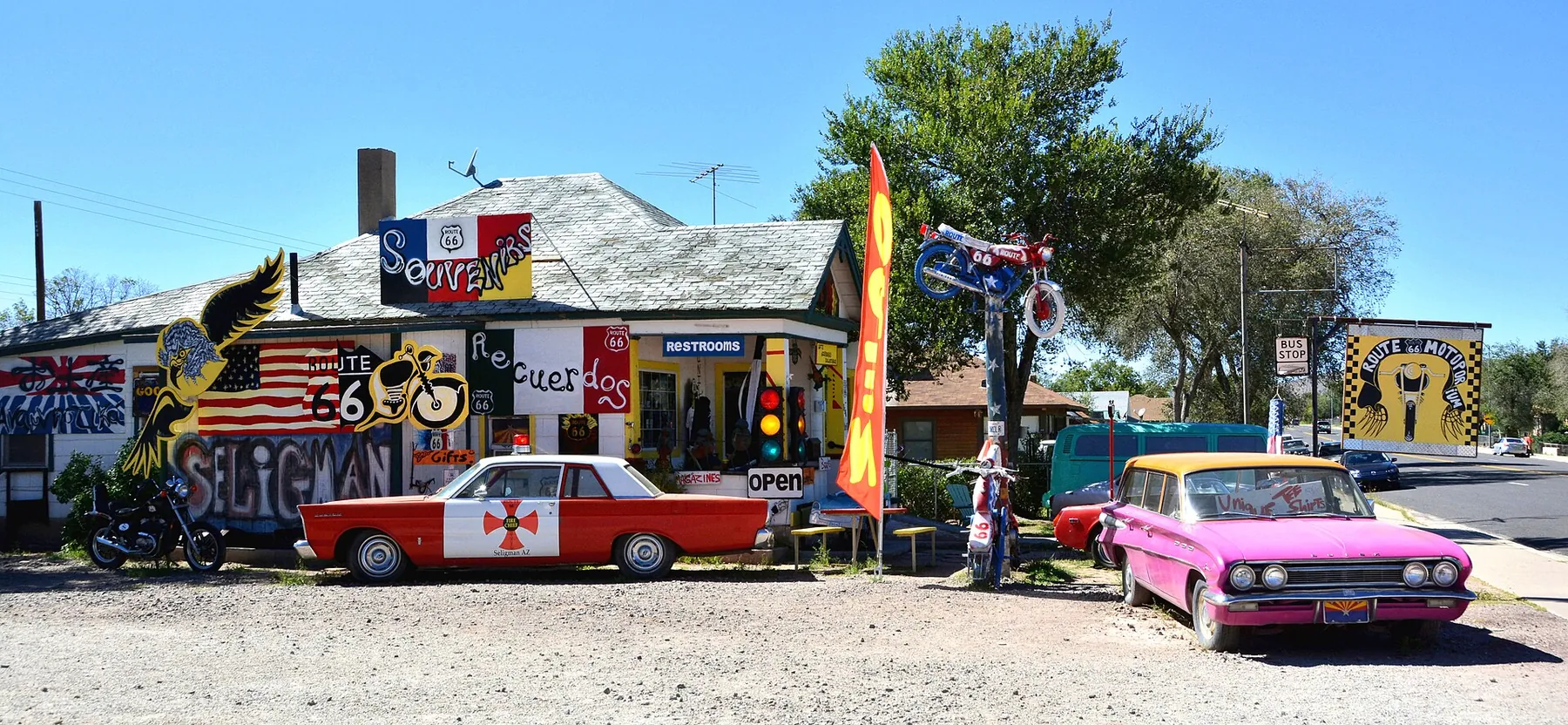
Seligman is where the revival of Route 66 began. When I-40 bypassed the town in 1978, local shop owners, led by the barber Angel Delgadillo, founded the Historic Route 66 Association of Arizona in 1987 to bring travellers back. Today the short main street is lined with old motels, souvenir shops and the Snow Cap drive-in, built in 1953 by Juan Delgadillo. The town is also among those that inspired Radiator Springs in the film Cars.
East of Seligman the old road rejoins I-40 near Crookton Road, and the interstate carries you on to Williams for the night.
Day 2: the Grand Canyon from Williams
Williams is about an hour from the South Rim by car via AZ-64, according to the National Park Service, and it is where the Grand Canyon Railway starts: a daily train that leaves at 9:30 and gives you more than three hours at the rim. Driving gives you more time and the chance of sunset at the canyon; the train spares you the drive and the parking.
Remember the fees. Since January 2026, visitors who are not US residents pay $100 each, aged 16 and over, on top of the $35 vehicle pass, unless they hold an annual pass. Our guide to Grand Canyon entrance fees in 2026 explains when the $250 America the Beautiful pass is worth buying.
Back in Williams in the evening, the main street along the old highway is busy with diners and neon. The town's historic business district was added to the National Register of Historic Places in 1984.
Day 3: Williams to Flagstaff
The road climbs from high desert into ponderosa pine forest. Flagstaff, at 6,903 ft (2,104 m) according to AAA, sits higher than any other town on Route 66. Its downtown lies on the original road, and the visitor centre is in the old railway station. Lowell Observatory, where Pluto was discovered, is on the hill above the centre, and Flagstaff was the world's first International Dark Sky City, so it is a good place for an evening of stargazing. Walnut Canyon, Sunset Crater and Wupatki national monuments are all within a short drive if you want to spend the afternoon outdoors.
Day 4: Flagstaff to Holbrook, via Meteor Crater and Winslow
East of Flagstaff the forest gives way to open desert. Turn off for Meteor Crater, a nearly mile-wide impact crater on a short detour from the interstate, about 20 minutes west of Winslow.
In Winslow, the old road becomes Second Street and passes Standin' on the Corner Park, the corner from the Eagles song. It was unveiled in 1999 with a bronze statue and a trompe-l'oeil mural that was repainted in 2023, with a real flatbed Ford parked at the kerb; a statue of Glenn Frey was added in 2016. Nearby, La Posada, a hotel designed by Mary Colter and opened by the Fred Harvey Company in 1929, is worth a look for its architecture even if you are not staying.
Continue east to Holbrook, home of the Wigwam Motel, a row of concrete teepees built by Chester Lewis and still run by his family. Holbrook is the closest town to the southern entrance of the Petrified Forest, so it makes sense to sleep here or in Winslow.
Day 5: Petrified Forest National Park
Petrified Forest is the only national park that contains part of Route 66. A 28-mile (45 km) road runs through it between the south entrance on US-180, 19 miles (31 km) from Holbrook, and the north entrance at I-40 exit 311. Drive it from south to north: start with the fossil logs of the southern section, then climb to the Painted Desert viewpoints and the Painted Desert Inn, a National Historic Landmark. Near the north end, a rusting 1932 Studebaker marks the line of the old highway. AAA suggests the park can easily fill half a day.
As of October 2026, the park is open 8:00 to 17:00 all year except Thanksgiving and Christmas, and the Painted Desert Inn from 9:00 to 16:00. Entry is $25 per vehicle for seven days, and no separate nonresident charge is listed. From the north entrance you can rejoin I-40 east towards New Mexico or west back to Holbrook.
Route 66 at 100: what is still to come in 2026
Many of the centennial events in Arizona took place earlier in the year, including the Historic Route 66 Fun Run from Seligman to Kingman and Topock in early May and festivals in Holbrook, Williams and Winslow. As of mid-October 2026, these were still ahead, according to Explore Kingman:
- Kingman Route 66 Fest: 16–17 October 2026.
- The road's 100th birthday: 11 November 2026.
- Route 66 UltraRun, Seligman, Kingman and Topock: 13–16 November 2026.
Expect busier motels around these dates, and check the Historic Route 66 Association of Arizona for the full calendar.
When to go
Spring and autumn are the most comfortable seasons for the whole route. In summer, the western end around Kingman and Oatman is hot, and from July to mid-September monsoon thunderstorms build most afternoons over the plateau. In winter the South Rim averages about 5 ft (1.5 m) of snow, and nights at the South Rim fall below freezing from about mid-October. Arizona does not use daylight saving time, so clocks here stay the same all year.
Where to sleep along the way
Each stop has a different character. Kingman has the most choice at the western end; Seligman has a handful of small independent motels; Williams works for the train and the canyon; Flagstaff has the widest choice and the best restaurants; and Winslow and Holbrook serve the Petrified Forest. Our guide to where to stay for the Grand Canyon and Route 66 compares the areas, and Tusayan, Williams or Flagstaff looks closely at the canyon bases.
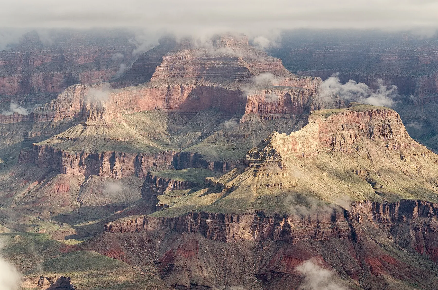 Photo: Tuxyso, CC BY-SA 3.0
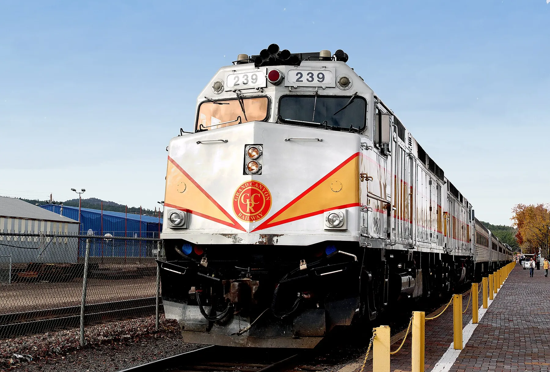 Photo: Bernard Spragg. NZ from Christchurch, New Zealand, CC0
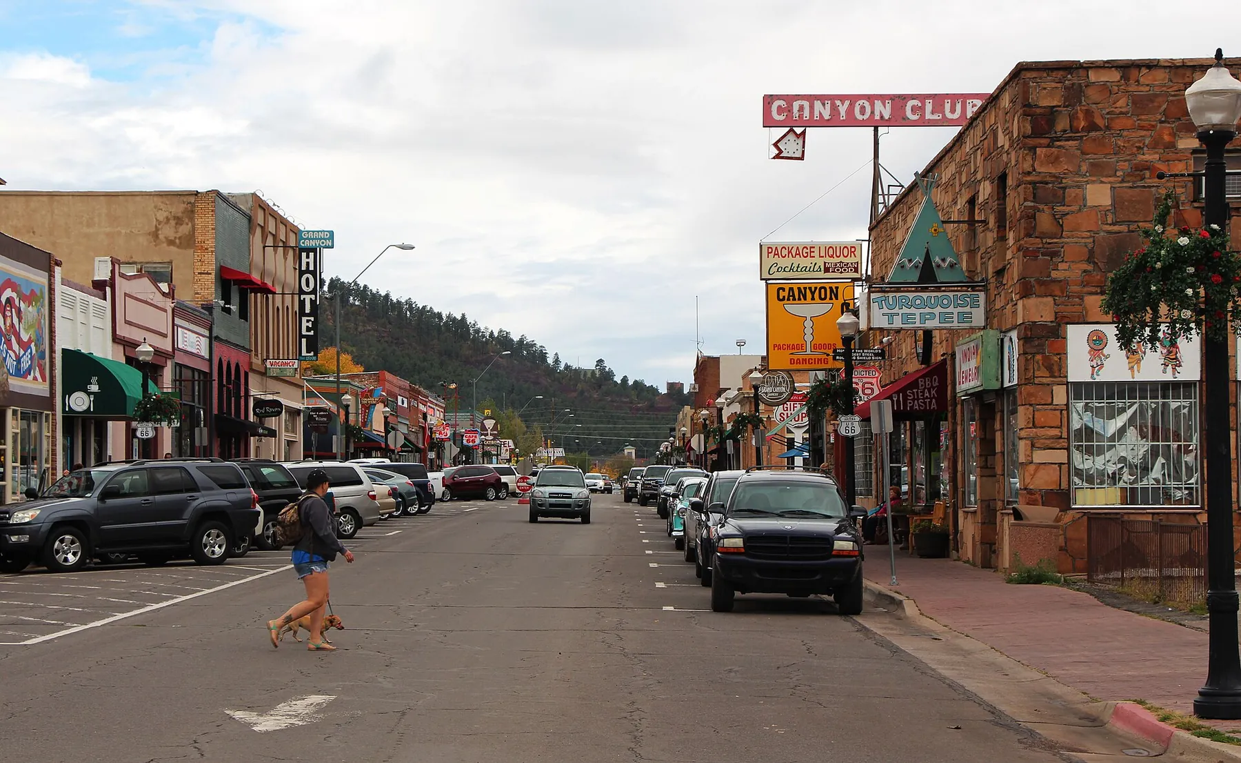 Photo: Steven C. Price, CC BY-SA 4.0