
 Photo: Grand Canyon National Park, CC BY 2.0
One day is enough to see the South Rim of the Grand Canyon properly, as long as you plan around three things: where you park, which shuttle you take, and where you are at sunset. This guide sets out a full day from Mather Point to Hermits Rest, with a short hike below the rim and an alternative route east along Desert View Drive.
Shuttle times, opening hours and closures are taken from the National Park Service as of October 2026. They change with the seasons, so check the shuttle page before you go.
The short answer
- Arrive before 10 am and park at the Grand Canyon Visitor Center, or in the village lots if those are full.
- Morning: Mather Point, then either a short hike down the South Kaibab Trail to Ooh Aah Point or a walk along the Rim Trail to Yavapai Point.
- Midday: walk or take the shuttle to Grand Canyon Village for lunch and the historic buildings.
- Afternoon and sunset: the free red shuttle along Hermit Road, with sunset at Hopi Point or Mohave Point.
- Alternative: drive Desert View Drive east to the Watchtower and leave the park by the East Entrance, if your trip continues towards Page or Monument Valley.
Which base for a one-day visit
Where you sleep decides how early you can start and how late you can stay. The park puts the South Entrance 6 miles (10 km) north of Tusayan, about 60 minutes from Williams and about 90 minutes from Flagstaff. Phoenix is about four hours away, and Las Vegas is a longer drive: see Las Vegas to the Grand Canyon and Phoenix to the Grand Canyon.
If you are driving from Phoenix or Las Vegas on the same day, you will arrive around midday and the plan below shrinks to the afternoon and sunset. Sleeping the night before in Tusayan, Williams or Flagstaff gives you the full day. Our comparison of Tusayan, Williams or Flagstaff goes into the trade-offs.
The free purple shuttle from Tusayan into the park is not running as of October 2026 and is due back in summer 2027, so plan to drive in. If you would rather not drive at all, the Grand Canyon Railway from Williams gives you a few hours at the rim, enough for Mather Point, the village and part of the Rim Trail but not for this full plan.
Before you leave, sort out the entrance fee: in 2026, visitors who are not US residents pay $100 each, aged 16 and over, on top of the $35 vehicle pass, unless they hold an annual pass. The visitor centre does not sell passes. Details are in Grand Canyon entrance fees in 2026.
Parking and shuttles
The four car parks around the Grand Canyon Visitor Center (Lots 1–4) are the closest to Mather Point. On busy days, such as spring break, summer and holiday weekends, the park says they fill by about 10 am. If they are full, drive on to the village lots: Lot A, near park headquarters, rarely fills completely, and Lot D, near the Backcountry Information Center, often has space and is a short walk from the Hermit Road shuttle and the Bright Angel Trailhead.
Once parked, use the free shuttles. As of the autumn 2026 schedule:
| Route | Where it goes | Hours | Round trip |
|---|---|---|---|
| Village (blue) | Visitor Center, Market Plaza, lodges, Backcountry Information Center | 7 am to 9 pm | about 50 min |
| Kaibab Rim (orange) | Visitor Center, South Kaibab Trailhead, Yaki Point, Mather Point, Yavapai | 6 am to an hour after sunset | about 50 min |
| Hermit Road (red) | Village to Hermits Rest, nine viewpoints | 8 am to an hour after sunset, every 12 min | about 80 min |
| Hikers' Express | Bright Angel Lodge, Backcountry Information Center, Visitor Center, South Kaibab Trailhead | departures 6, 7 and 8 am | one way |
Two rules matter. The South Kaibab Trailhead is closed to private cars, so you reach it only by shuttle. And Hermit Road is closed to private cars from 1 March to 30 November; in December, January and February it opens to cars and the red shuttle does not run. Pets are not allowed on the shuttles.
A one-day plan for the South Rim
| Time | What | How |
|---|---|---|
| 7:30–8:30 am | Park at the Visitor Center, walk to Mather Point | On foot from the plaza |
| 8:30–10:30 am | Hike to Ooh Aah Point and back | Orange shuttle to the South Kaibab Trailhead |
| 10:30 am–12:30 pm | Rim Trail from Mather Point to Yavapai Point and on to the village | On foot, or the orange and blue shuttles |
| 12:30–2 pm | Lunch and the Village Historic District | On foot |
| 2–6 pm | Hermit Road viewpoints and a walk on the Rim Trail | Red shuttle from the Hermit Road transfer stop |
| Sunset | Hopi Point or Mohave Point | Red shuttle; last bus about an hour after sunset |
The times suit a spring or autumn day. In October 2026, sunset at the South Rim is around 5:50 pm; in June it is closer to 7:45 pm. Arizona does not use daylight saving time.
Morning: Mather Point and a short hike
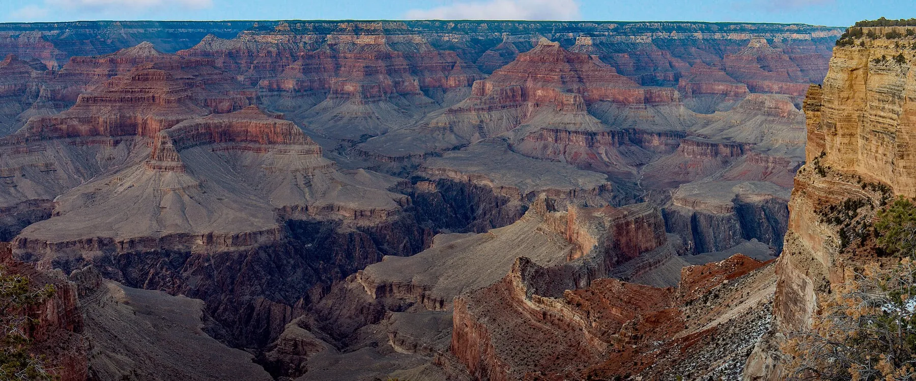
Mather Point is a short walk from the visitor centre plaza and is the first view of the canyon for most visitors. It is calmest early in the morning.
From the visitor centre, take the orange Kaibab Rim shuttle eastbound to the South Kaibab Trailhead. The hike to Ooh Aah Point is 0.9 miles (1.4 km) each way, 1.8 miles (2.9 km) return, and drops about 600 ft (183 m). The park advises allowing about twice as long to climb back up as to walk down, so allow roughly two hours in all. Fill your bottles at the trailhead: there is water there all year but none on the trail, and there are no toilets at Ooh Aah Point. If you are fit and it is cool, Cedar Ridge is 1.5 miles (2.4 km) each way and about 1,140 ft (347 m) below the rim, and has toilets; it is also the park's recommended turnaround for summer day hikes.
The trail has little shade and can be icy in winter and early spring. Give way to hikers coming uphill, and if you meet a mule train, step to the uphill side and wait for the wrangler's instructions.
Late morning: the Rim Trail to the village
Back at the rim, walk the Rim Trail west from Mather Point. It is about 0.7 miles (1 km) and 15 to 30 minutes on a paved path to the Yavapai Geology Museum, and about 2.5 miles (4 km) in all to the Grand Canyon Village historic district; the park estimates 45 minutes to two hours for that stretch, mostly downhill. You can stop at any point and pick up the blue shuttle.
The village has the historic lodges, Verkamp's Visitor Center, the start of the Bright Angel Trail and several places to eat. It is the natural lunch stop. Water is available in the village and at Hermits Rest, but not along the Rim Trail.
Afternoon and sunset: Hermit Road
From the Hermit Road transfer stop at the west end of the village, the red shuttle runs 7 miles (11 km) to Hermits Rest. Going out, it stops at all nine viewpoints: Trailview Overlook, Maricopa Point, Powell Point, Hopi Point, Mohave Point, The Abyss, Monument Creek Vista, Pima Point and Hermits Rest. On the way back it stops only at Hermits Rest, Pima Point, Mohave Point and Powell Point, so visit the others on the way out.
A good pattern is to ride to Hermits Rest, which has a snack bar, a shop and toilets, then hop back east and walk a section of the Rim Trail between viewpoints. From Monument Creek Vista to Hermits Rest the path is paved and shared with cyclists; between Powell Point and Monument Creek Vista it is a narrow dirt trail.
For sunset, the park names Hopi Point and Mohave Point as popular spots. Both are on the return route, and the last bus leaves about an hour after sunset, so you can stay until the light goes.
Alternative: Desert View Drive and the East Entrance
If you are heading on towards Page, Antelope Canyon and Horseshoe Bend or Monument Valley, swap the Hermit Road afternoon for Desert View Drive, which you drive in your own car. It runs 23 miles (37 km) from the village to Desert View and the East Entrance, with viewpoints at Grandview Point, Moran Point and Navajo Point, the highest overlook on the South Rim. Lipan Point is closed for rehabilitation from 22 June to 23 December 2026. Yaki Point, near the start, is reached only by the orange shuttle.
At Desert View, the upper floors of the Watchtower open from 8 am to 6 pm when staffing allows, with free timed tickets, a limit of 25 people at a time and last access at 5 pm. There is a market and deli (9 am to 5 pm) and a pay-at-the-pump petrol station open 24 hours. From the East Entrance it is 25 miles (40 km) to US 89 at Cameron.
Season adjustments
- Summer: thunderstorms build most afternoons from July to mid-September, and the park suspends the Hermit Road shuttle during storms. Hike in the morning and stay near a building or your car in the afternoon.
- Winter: drive Hermit Road yourself (December to February, weather permitting), allow for icy paths, and remember that sunset is around 5:15 pm.
- Busy months: arrive by 10 am or go straight to Lot D or Lot A.
Safety on the rim
The South Rim is at around 7,000 ft (2,100 m), and the Rim Trail varies by only about 200 ft, but the altitude still tires people who arrive from sea level. Walk slowly, drink and eat salty snacks. Stay behind railings and well back from unfenced edges, especially when taking photographs. In a thunderstorm, leave exposed viewpoints. Do not try to hike to the river and back in a day, which the park warns against, especially from May to September.
Where to stay
For a one-day visit, the base that gives you the most time at the rim is Tusayan, at the South Entrance: you can be at Mather Point early and drive back after sunset in minutes. Williams suits travellers who want lower prices, the train or Route 66, and Flagstaff suits those who want a real town and accept a 90-minute drive at each end of the day. If you can add a second night, read when to visit the Grand Canyon and the South Rim viewpoints to plan a sunrise as well.
Our guide to where to stay for the Grand Canyon and Route 66 compares Tusayan, Williams, Flagstaff and the Route 66 towns, with the pros and cons of each area.
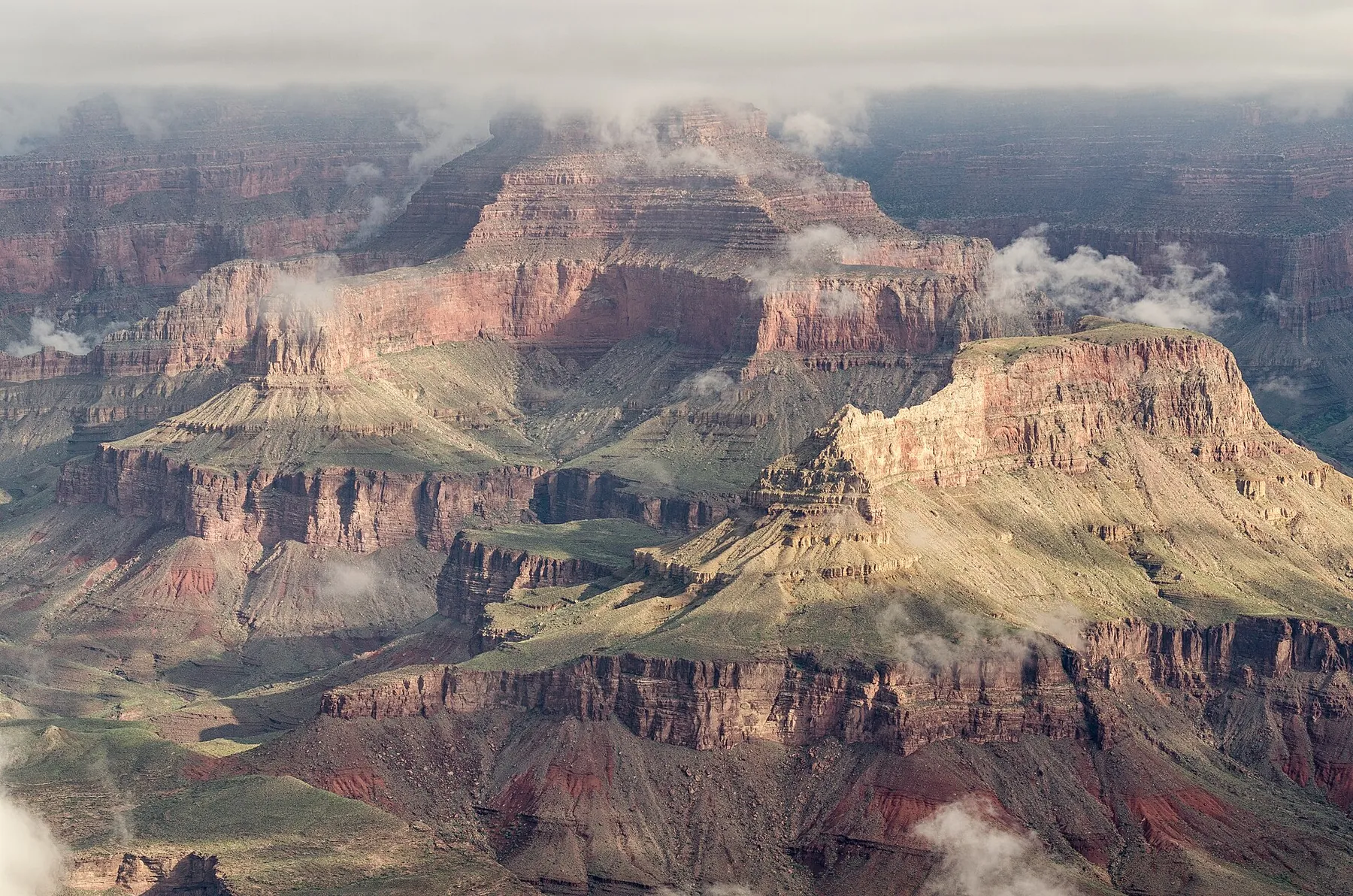 Photo: Tuxyso, CC BY-SA 3.0
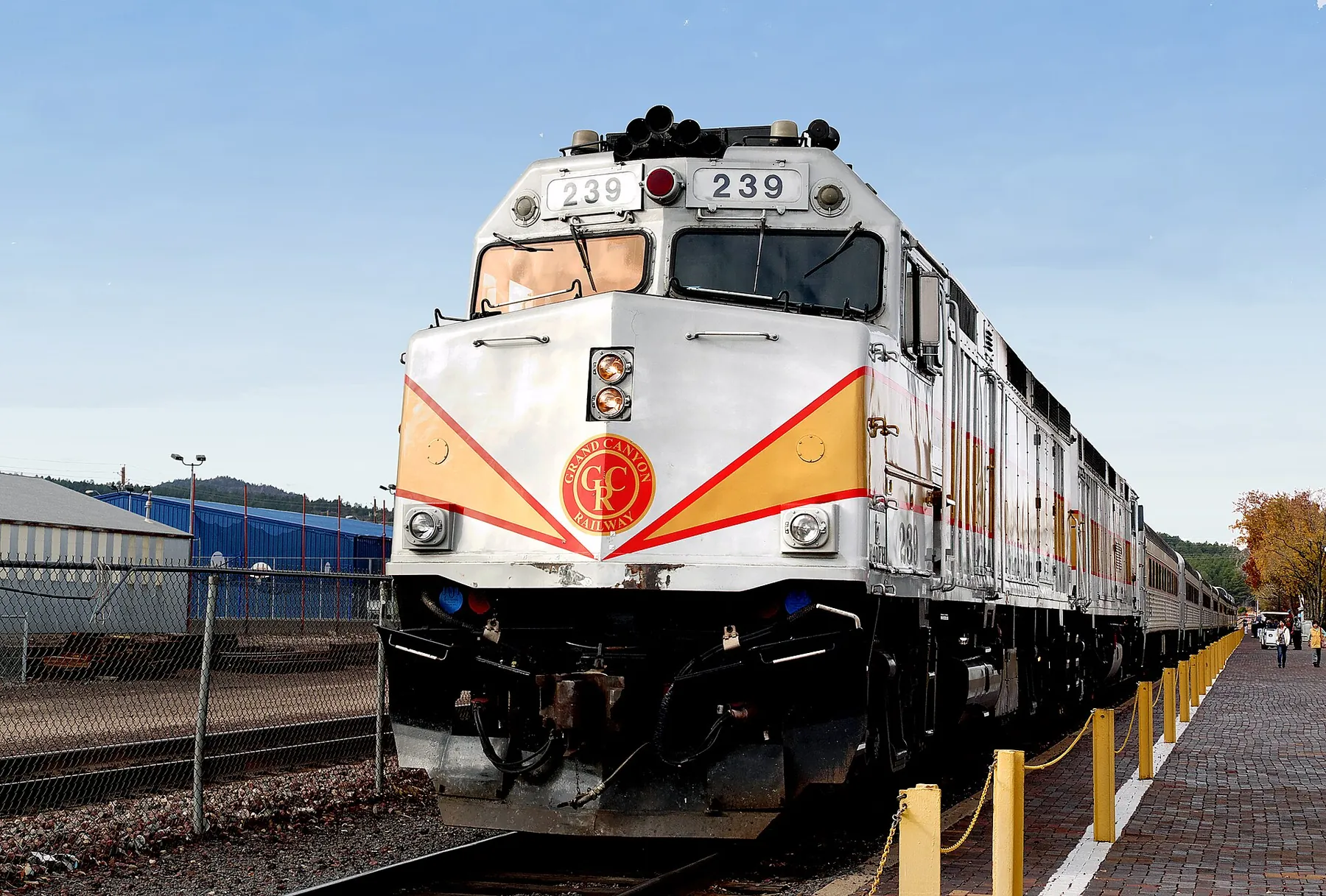 Photo: Bernard Spragg. NZ from Christchurch, New Zealand, CC0
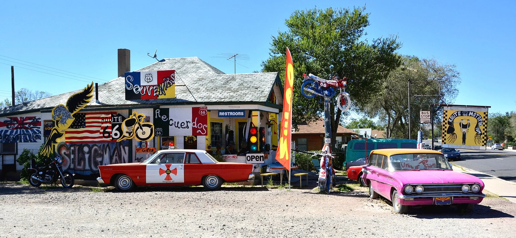 Photo: Mike McBey, CC BY 2.0